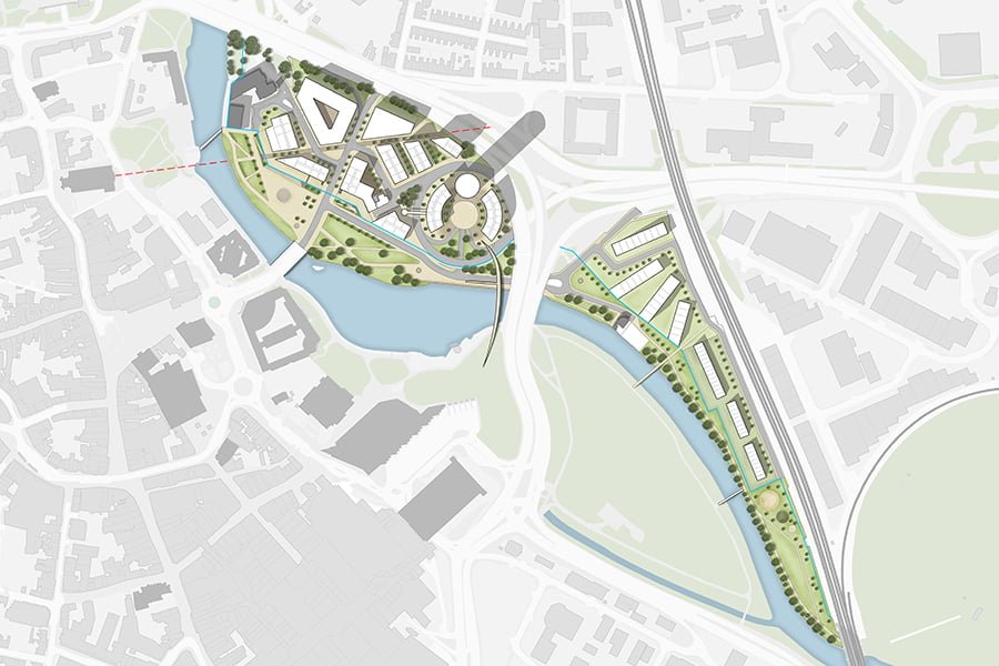


TEP was appointed by Derby City Council to lead this city centre riverside masterplan and to advise in relation to urban design, architecture, development economics and access and movement. The masterplan is complex as part of the 11 hectares will need to accommodate a flood conveyance corridor associated with the River Derwent and a flood defence barrier alignment remote from the river’s edge. A portion of the site also falls within the buffer to the Derwent Mills World Heritage Site.
Supported by architects Buttress, transport planners Mott MacDonald and economic advisors Genecon, TEP have developed a mixed use masterplan incorporating a new riverside park that would deliver a great asset for the city but would also form part of a flood conveyance corridor in times of extreme flooding, protecting the wider city centre from flood water. Fronting the park will be an innovative area of public realm that will also integrate the flood defence barrier. On the ‘land side’ of the barrier will be a high quality mixed use development providing much needed new homes and space for employment, along with retail and leisure opportunities.
TEP have prepared a number of masterplan options that test the approach to the proposed riverside park, mixed use development and network of streets. The masterplan options were modelled in terms of predicted socio-economic and environmental benefits and a recommendation for the preferred option was submitted to the City Council and Environment Agency for approval.
TEP prepared three dimensional modelling to review the Derby Riverside Masterplan in the context of the wider city centre model. Development guidance was also prepared that will convey the vision for Derby Riverside and the expectations for high standards of design for the 5-10 year development period.