The concept of “Natural Capital” has been gaining traction in UK and international policy, with growing recognition that if economic growth is to be sustained, Natural Capital has to be safeguarded. As landscape professionals, TEP aims to shape better environments for the next generation. In the UK, the most challenging arena is the post-industrial landscape, where there are intense development pressures in landscapes needing restoration.
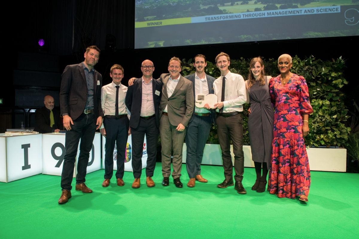
TEP and VIVID Economics have developed an integrated Ecosystem Service Mapping Tool, as part of their work for Greater Manchester Combined Authority (GMCA) on the EU-funded Natural Course project. The project recently won the Landscape Institute’s Transforming through Management and Science award.
NATURAL CAPITAL AND ECOSYSTEM SERVICES
Natural Capital is the store of natural assets in an area, such as air, water, soil or woodland. These natural assets provide a flow of services that underpin the economy, referred to as Ecosystem Services (ESS). We rely on ESS for many social, environmental and economic benefits such as:
Using spatial and statistical metrics, the value of ESS derived from many Natural Capital assets can be monetised, providing a quantifiable estimate of the benefits they provide to society.
A NATURAL CAPITAL APPROACH
The government’s 25-year plan for the environment promotes a Natural Capital approach, acknowledging areas such as river catchments as building blocks for long-term protection and enhancement of Natural Capital. The approach involves demonstrating how the habitats in an area contribute to society by illustrating the level and availability of ESS provided by natural assets. Measurement and valuation of ESS can provide essential data about who and what will benefit from the services. This can then be used to provide an evidence base for decision makers to determine what ESS enhancement measures might deliver greatest public benefit; and to assess the potential loss of benefits arising from intensification of land use.
ECOSYSTEM SERVICE OPPORTUNITY
An ESS opportunity arises on land which, given its physical, social, economic, geographical and cultural characteristics, offers potential to intervene and improve ESS functioning, and consequently boosts an area’s Natural Capital.
ESS opportunities arise where there is a combination of feasibility and need. The decision-maker can examine whether significant changes could be made to improve ESS functioning and whether there is a need for improvement? For example some land uses are incapable of significant change to improve ecological functioning, such as road surfaces, cemeteries and private residences. Whereas others may already be in optimal ecological condition for example woodlands cannot be bettered in respect of carbon sequestration.
TEP has designed an award winning ESS opportunity mapping tool which helps organisations with the following analyses:
All this data can be captured and interpreted through an ESS Opportunity Mapping tool, which visualises the scale of opportunities available in a given area, appropriate types of interventions, and priorities for investment in Natural Capital.
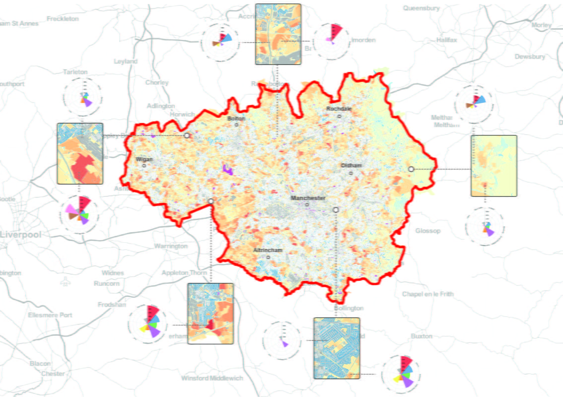
ESS OPPORTUNITY MAPPING IN THE RIVER IRWELL CATCHMENT
The ESS Opportunities Mapping Tool identified where ESS could be enhanced within the Irwell Management Catchment and communicated the opportunities for Green Infrastructure improvements that would increase the flow of ESS. The mapping helped validate GMCA’s project ideas and stimulate further development opportunities; ranging from small scale enhancements to large ambitious proposals.
This project shows that providing a better understanding of the significant monetary value of the ESS can help direct investment to areas that need it the most. The innovative method used in the project is wholly replicable and could be used across different landscapes and varying scales. The project sets a precedent whereby GMCA and their stakeholders have been provided with a robust evidence base which can be interrogated on the MappingGM web tool, meaning we leave behind the tools for GMCA to identify and implement future opportunities.
“As part of the Government’s Urban Pioneer there are a number of exciting natural capital initiatives being developed across Greater Manchester. The ESS opportunity tool for Greater Manchester provides an excellent opportunity to support and inform future decisions on the protection of our natural environment and investment in projects.”
Krista Patrick,
GMCA Natural Capital Coordinator
If you would like to learn more about ESS mapping and our GIS services, we have CPD workshops available or get in touch with our GIS team, who would be happy to discuss your requirements.