Happy GIS Day 2025!
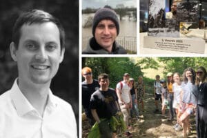
To mark GIS Day, Associate Director Colin Bourne reflects on his 23-year journey through the geospatial profession, from cartography and …

To mark GIS Day, Associate Director Colin Bourne reflects on his 23-year journey through the geospatial profession, from cartography and …

Manchester City Council has recently released its draft Local Plan for consultation, and TEP is proud to have played a …

TEP is proud to announce our partnership with Time for Geography, a pioneering initiative that showcases the importance of geography …

Great Britain’s INNS Strategy provides a strategic framework within which the actions of government departments, their related bodies, and key …

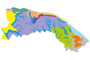
TEP was commissioned by the Greater Manchester Combined Authority (GMCA) as part of the Natural Course EU LIFE Integrated Project, …

In a monumental move towards ecological sustainability, significant changes in Biodiversity Net Gain (BNG) legislation are set to come into …
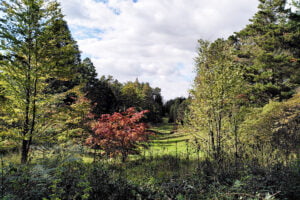
The Bedgebury Masterplan establishes a vision and spatial framework, supporting the delivery of Forestry England’s national priorities, promoting sustainable forestry …
The 15th November is Annual GIS Day, a perfect and opportune moment to reflect on our GIS team’s achievements from …
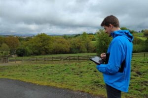
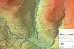
Over the past few months, the GIS team has been working on a desktop and mobile data capture tool for …
TEP’s GIS team is involved in an ambitious new initiative, which is to compile a spatial database of Landscape Character …

“Historically, our waterways were fundamental to Manchester’s rise to economic power. They remain at the heart of what makes the …

Last week the Landscape Institute hosted its annual awards ceremony, which is all about celebrating people, place and nature, and …