Many reports, including Public Health England’s recent Improving access to greenspace: A new review for 2020, have emphasised the importance of urban greenspaces to physical and mental health. They are spaces in which we exercise, connect with nature and socialise with friends. This has been highlighted to many of us over the past 18 months as we (re)discovered our local greenspaces. However, as explored in TEP’s Greenspaces Out of Bounds article, there is inequality in those who benefit from urban greenspaces, so there is still work to do for practitioners to ensure these benefits are shared equally.
Information on the use of a greenspace is a key aspect of the evidence base for landscape practitioners. If we can identify the most common activities for visitors, the demographics of the users and the areas of the greenspace which are frequently used, the landscape design and management can be tailored to maximise the benefits they provide to all. However, it is difficult to obtain a representative picture through current methods – could the growing geospatial industry provide a solution?
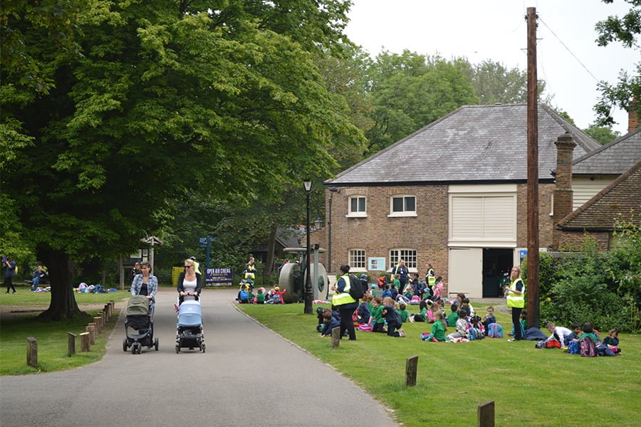
Traditional methods to capture greenspace activity include the use of visitor counts (standing at the entrances using a trusty clipboard and clicker). These techniques can be useful to estimate use on a particular day. However, a huge time commitment is required to obtain an accurate picture of the temporal and spatial fluctuations in greenspace activity. Improvements in technology over the past decade, particularly the introduction of Global Positioning Systems (GPS) in mobile phones, have increased the amount of spatial data produced by the public, which can be used in Geographic Information Systems (GIS) to estimate greenspace activity through several different approaches, including the use of social media, exercise applications and citizen science.
Many social media platforms now allow users to tag posts with a spatial location, such as a popular landmark or restaurant. Through data mining techniques it is possible to process the masses of data produced by users of platforms such as Instagram, Twitter and Facebook to estimate the number of visitors to a greenspace over a particular time period. This presents an opportunity to collect information from a huge amount of users over a much longer period of time, creating a more accurate representation of greenspace activity than traditional methods. However, this approach presents an ethical dilemma for practitioners over the use of personal location data. Something which has been identified in the national Geospatial Strategy as an area that requires further guidance and is anticipated for release within the next year.
Some exercise-focused applications, such as Strava, process the routes recorded by users into a commercial product (Strava Metro), which could be used by practitioners to estimate the number of greenspace users. The dataset is anonymised to protect users’ identities and processed to remove a lot of the ‘noise’ associated with large crowdsourced datasets, which presents greenspace practitioners an ‘off the shelf’ source of greenspace activity. However, the nature of the application can introduce user bias, focusing on those who use the greenspace for active recreation such as running or cycling, ignoring many casual users such as young families or those who go to socialise. This method could also include a cultural bias to certain demographic or economic groups, who are more frequent users of exercise applications.
The increasing accessibility of GPS-enabled mobile phones has facilitated the growth of Geographic Citizen Science, where volunteers record spatial data as part of a wider project. This has been successfully implemented within fields such as invasive species management, traffic management and epidemiology; and could have a role to play in the estimation of greenspace activity. If an application or website were available for members of the public to log their use of a greenspace and provide the spatial locations of the activities, this could provide practitioners with a huge insight into the use by the public. This technique could also be applied to other landscape assessments. The guidance for the assessment of Natural Capital identifies several sources of information to estimate the value of natural assets, including the use of visitor numbers to determine the recreation and tourism benefits. Citizen science could be a way to collect valuable data for assessments but also increase engagement of the local community with greenspaces. Like other public consultation techniques, this approach would succeed or fail on the participation of volunteers, so an effective engagement strategy would need to be formulated to maximise the number of responses and address bias introduced in other approaches.
It appears that currently, there is no best method to capturing greenspace activity. Each approach, including traditional visitor counts, presents benefits and considerations for greenspace practitioners, and the decision over which is best is project-specific, depending on the goals and the resources available. However, what can be agreed on is that the technological improvements over the last decade have increased the variety of methods available to estimate greenspace activity and the evidence available to assist in important planning decisions.
Joe O’Reilly
Senior GIS Consultant