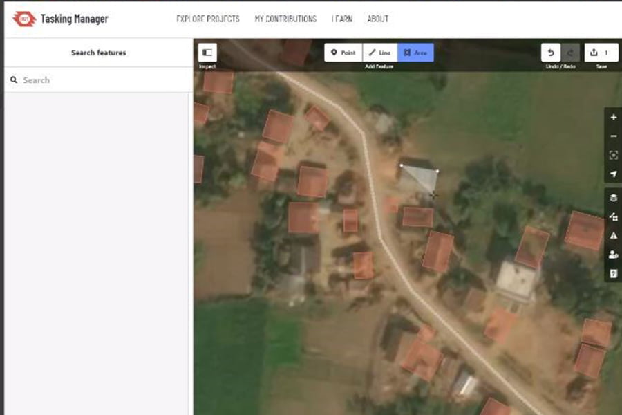
Last Friday, TEP’s Geographical Information Systems (GIS) team collectively spent 24 hours adding to Missing Maps. Missing Maps is an organisation that maps features such as roads and buildings in places affected by humanitarian crises. Creating detailed mapping for these areas can better facilitate disaster responses, medical activities, and resource allocation if a crisis occurs.
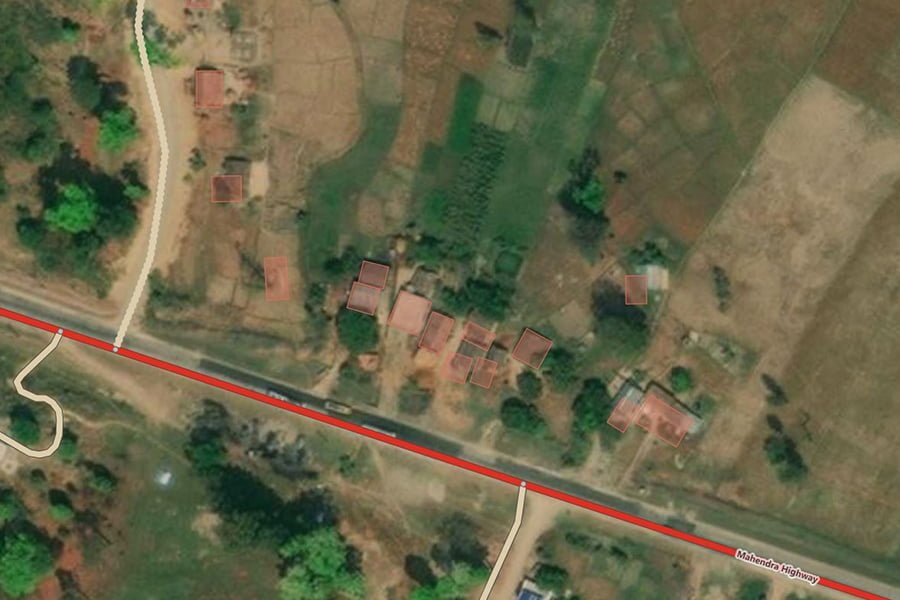
The Kathmandu Valley in Nepal is susceptible to earthquakes. The latest earthquake on April 25th 2015 killed nearly 9,000 people, destroyed villages, and damaged several structures in Nepal’s capital city, Kathmandu. Repair work is still ongoing and is extremely difficult. Finding ways to minimise the initial impact of any future quake is critical. Nepal Red Cross (NRCS) implemented a programme from 2012 to 2015 to help the Kathmandu Valley prepare for earthquakes. The British Red Cross built on this programme and created the Strengthening Urban Resilience and Engagement (SURE), which expanded work in seven municipalities across three of Nepal’s major urban centres. The British Red Cross currently is mapping Dhangadhi sub-metropolitan city and the surrounding areas in Far-Western Nepal.
Mapping features in these areas creates a base map that can give an overview of which citizens are aware of hazards and their locations and better determine the risks to the community. This vital information is shared with NRCS and the municipal government for resilience planning.

TEP offers all staff one day per year to participate in a volunteering activity as part of their corporate social responsibility (CSR) commitments. These volunteering days are a valued part of TEP’s culture and their wider CSR programme. These days help enrich our staff and provide them with an opportunity to help local community groups and charities; previously TEP has volunteered at RHS Bridgewater, the Wildlife Trust’s Red Rocks Site of Special Scientific Interest and Clwydian Range and Dee Valley Area of Outstanding Natural Beauty. However, due to COVID-19, it has been increasingly difficult to volunteer in social group events, so the GIS team turned to remote volunteering. Everyone was able to access the website in their own homes via the Missing Maps website. To keep the social element to the activity and offer words of encouragement along the way, the team joined a group call and worked alongside each other mapping the same project.
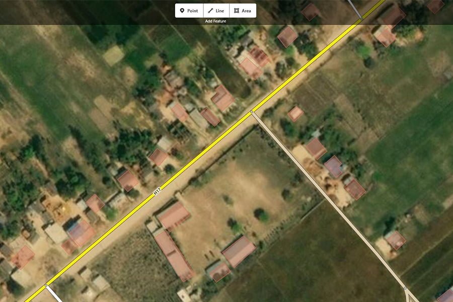
Overall, the team mapped 800 buildings and 30 km of road. This will no doubt help towards achieving the British Red Cross’ mission and future communications throughout Nepal. The whole team look forward to their next project and encourage others to also make a difference.